The history of Lukla Airport (LUA) stretches back in the 1970s, when the original runway was gravel with a sparse grass covering. A siren would warn of an approaching aircraft so the cattle could be cleared. This was also the case when the first aircraft landed in Lukla. Cattle had to be cleared off the runway after a Sherpa in the Lukla heard the sound of an aircraft intending to land there. The following photograph of Lukla Airport’s runway in the years gone by is a testament to this fact.
| Lukla Airport | Details |
|---|---|
| Name | Tenzing–Hillary (Lukla) Airport |
| Location Indicator | VNLK |
| Aerodrome Reference Code | 1 ‘A’ Type 3 |
| Aerodrome Reference Point | 27°41′16″ N / 086°43′53″ E |
| Province / District | Province 1 (Solukhumbu District) |
| Distance and Direction from City | Amidst Lukla Bazaar |
| Elevation | 2,846 m / 9,338 ft (Ref: Topographical Base Map, Survey Dept.) |
| Status | Operational |
| Year of Start of Operation | September 1971 |
| Serviceability | All-weather |
| Land Area | Approx. 81,509.93 m² |
| Refueling Facility | Not available |
| Service | Visual Flight Rules (VFR) |
| Type of Aircraft | D228, DHC-6, L410, Y12, C208 |
| Air Traffic Service | AFIS (Aerodrome Flight Information Service) |
| RFF (Rescue and Fire Fighting) Category | Not available |
| Infrastructure Condition (Airside) | Runway in good operational condition |
| Runway Surface Type | Bituminous paved (asphalt concrete) |
According to Hillary himself, he was rather tensed when the first aircraft approached Lukla as civil aviation authorities had decided to shut down another airport he had built in the Everest region prior to constructing an airport in Lukla. He reminisces the first landing that ever look place in Lukla in his autobiography “The View From the Summit” in the following way:
“ I admit to feeling rather tense as the Pilatus Porter circled overhead. Then the plane wheeled, its flaps came down and it swung in to the bottom of the strip. The wheels touched with a puff of dust and next moment it was rolling up the airfield and came to a rapid halt. It took full power for the plane to taxi to the top of the runway and then we were welcoming the clearly delighted crew and passengers. I had an enormous feeling of pleasure and relief.”

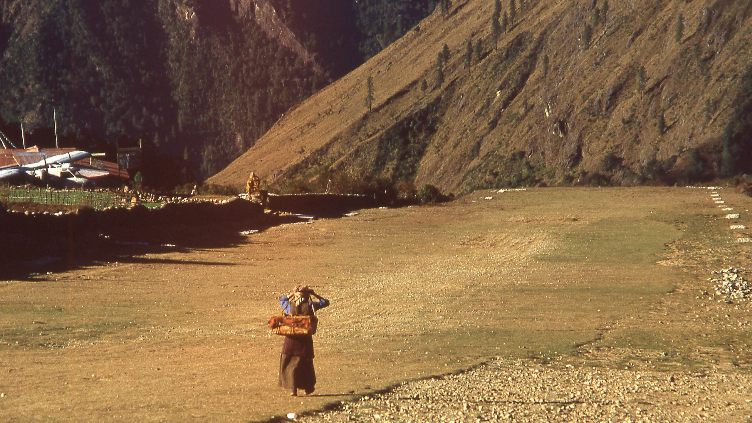
This is the picture from the runway of Lukla where cattle are grazing in Lukla Airport. According to Ngawang Karsang Sherpa, a resident of the region, cattle would be grazing around Lukla’s airstrip even as an aircraft landed. “During the summer time, the airport was home to plenty of grass, and this was good fodder for the cows. You could see aircraft landing in the airport and cows grazing quite near one another. Obviously, the airport is cemented now and the boundaries between airport’s area and animal’s area is clearly demarcated. But this wasn’t the case back then.”
Lukla Airport: Myths vs Facts of “the most dangerous airport”
The Origins of Lukla Airport: Sir Edmund Hillary’s Vision for the “Gateway to Everest”
It might come as a surprise to many that Lukla wasn’t the first airport that Sir Edmund Hillary had constructed in Lukla. He was the person who pioneered an airport in the Mingbo Valley, which lies at an altitude of 15,000 ft: in comparison, Lukla’s altitude is approximately 9,000 ft. The Mingbo airstrip was constructed to bring relief materials to the Tibetan refugees in the Khumbu region, and it was this aerodrome from where materials for the construction of the first school in the Everet region (i.e. Khumjung School) were transported by the locals. The following is a photograph of the Mingbo Airstrip in its present form:
The now forgotten/lost Mingbo Airstrip
The picturesque-ness of the airport is quite remarkable. And so are other snippets of its history:
- Constructed by hand, it was an engineering miracle achieved with local Sherpa ingenuity. With no machinery, Sherpas used traditional lever-and-crater techniques to move massive boulders and flatten terrain. The entire construction cost only $900, mostly labor wages.
- The airstrip supported critical missions—education and refugee relief. Hillary’s partnership with Captain Schrieber’s Pilatus Porter PC-6 enabled flights carrying food and materials for Khumjung School, one of the first Himalayan Trust schools, and emergency supplies for Tibetan refugees.
- Extreme altitude, turbulence, and weather made Mingbo unsafe and short-lived. Challenges such as mountain waves, “funneling” turbulence, fuel freezing, and hypoxia made it one of the most dangerous landing sites ever attempted.
Hillary gives an account of the flight of a civil aviation officer who flew to this airport to assess if the airport could be used for regular passenger/cargo operations:
“It was quite turbulent as we made our approach towards the hill at the bottom of the Mingbo runway. As Captain Schrieber headed down there was a fierce sideways gust of wind and the aircraft started sliding towards the left- hand edge of the field. Captain Schrieber’s reaction was immediate – he just dropped the aircraft from thirty feet to land with a huge thud and then rolled upwards close to the rocks on the left-hand side where we stopped safely at the top. We were all severely shaken. The Civil Aviation gentleman staggered out of the aircraft and vomited noisily.”
After such an experience, the Civil aviation officer decided to shut operations from this airport, which is now (albeit not regularly) used for transporting supplied/ relief, or emergencies into the region, as evidenced by the photograph below:

You can read about Mingbo airport in our guide below:
More dangerous than Lukla: Mingbo – the Forgotten Airport – Avio Space
Finding the perfect spot for constructing the most dangerous airport in the world
The photograph below is of the village of Chaurikharka, a place where Hillary thought he could construct an airport. Given that the region had stretches of flat land, he believed that the construction of an airport in Chaurikharka would make the region more accessile to people outside the Khumbu region. To put things into perspective: back when Hillary had constructed Mingbo, it would take people 17 seventeen days of walk to get to Mingbo valley [This is one of the reasons why the civil aviation personnel who decided to shut down Mingbo as soon as he landed there permitted one last flight from the airstrip, the flight that would take him to Kathmandu].
Although no one can be certain where he thought he could construct an airport in Chaurikharka, the place had a lot of flat land, where he could have constructed it. In his book, the View from the Summit:
“ I had noticed that below Chaunrikarka there was a large area of almost flat land pushing out into a curve of the Dudh Kosi. I asked Jim Wilson to investigate it and he reported that it just might do, but that it was barely long enough and also very fertile land, so that the local people might be understandably reluctant to sell. “
Later on, a few villagers in Lukla came up to Jim Wilson, who was with Sir Hillary, and said that they had land they were willing to sell for the construction of the airport. As two-thirds of the land were in rough pasture and heavy scrub (and one-third in potato field), Hillary figured out that construction of an airstrip there wouldn’t lead to destruction of arable land, as it would have been in Chaurikharka. Hillary purchased the land for a little over $600, which he thought was quite substantial, even for that time.
.jpg)
As shown (partly) in the picture, the rise from the bottom of the picture to the top was over a hundred feet. Talking to aviospace.org, trainer pilot Captain Rabindra Dangol said that international standards posit a runway’s slope to be acceptable at 2 degrees, but Lukla’s gradient is 11.7 degrees, making it a tad “weird” compared to the slope of runways in airports around the world.
Hillary (Lukla) Airport; crucial gateway to the majestic Everest
Lukla’s Engineering was based on Local Wine and Sherpa dancing
It might be hard to envisage but it was people from Lukla who approached Hillary’s team for Lukla Airport’s construction:
“ …was approached by a group of farmers from the small village of Lukla, which was located in a small tributary valley at 9,000 feet. They had some land for sale and thought it would be suitable for an airfield. They even suggested that the wind always blew in the right direction! How hill people who knew nothing about airfields could possibly make this sort of judgement I do not know, but when we went up to Lukla we agreed that they were right. And best of all we wouldn’t be destroying a lot of arable land.”
More than a hundred Sherpas cleared the ground with khukuris and mattocks, and did their best to level the fields. As was the case in Mingbo Airport, there were large boulders that needed to be moved. Locals used the same method that they did for the clearing large rocks out of the runway of Mingbo: “dug huge holes and then rolled the rocks into them and covered them up with earth“. The construction of the runway wasn’t completed but a “large Russian helicopter” did land at the airport before the first fixed-wing did.
Despite the best efforts, Hillary wasn’t convinced that the top surface was firm enough for a smooth landing, so he decided to be rather ingenious:
“Sherpa dancing is very vigorous and involves much stamping of the feet. We purchased large quantities of chang and then employed fifty Sherpas to link arms and stamp their way backwards and forwards across the field. A very festive mood prevailed and the earth received a most resounding thumping. Two days of this rather reduced the Sherpas’ enthusiasm for the dance but produced a firm and smooth surface for our airfield.”
By the end, the arfield was completed, and:
-
Sir Edmund Hillary spent approximately $2,000 on land and labor for the construction of Lukla Airport.
-
The original airstrip measured 1,150 feet in length and 100 feet in width, marked with white painted boards.
-
The airfield was completed in 1962, opened for official flights in 1971, and its runway was paved around three decades later.
.jpg)
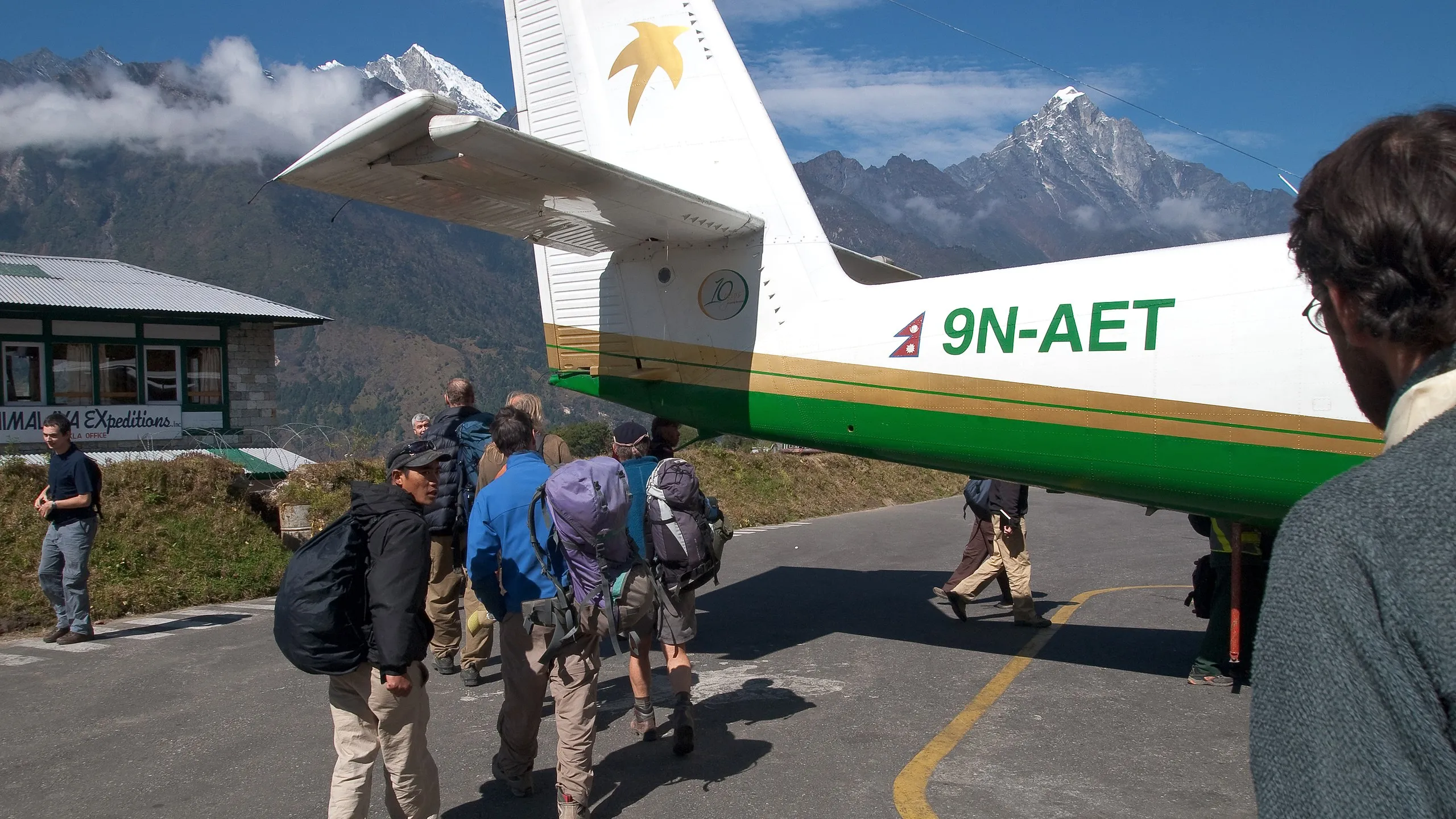
A Pilatus Porter aircraft (most probably of the type above) was the first fixed-wing aircraft to land in Lukla. [ Note: Hillary’s wife died in the 1975 crash of a Pilatus Porter aircraft as it was on its way to Phaplu Airport from Tribhuvan International Airport (TIA) in Nepal]. Since the time of the first flight, the aerodrome in Lukla has undergone many changes, as can be noted from the table below.
_shortly_after_landing_at_Lukla_Airport_1.jpg)
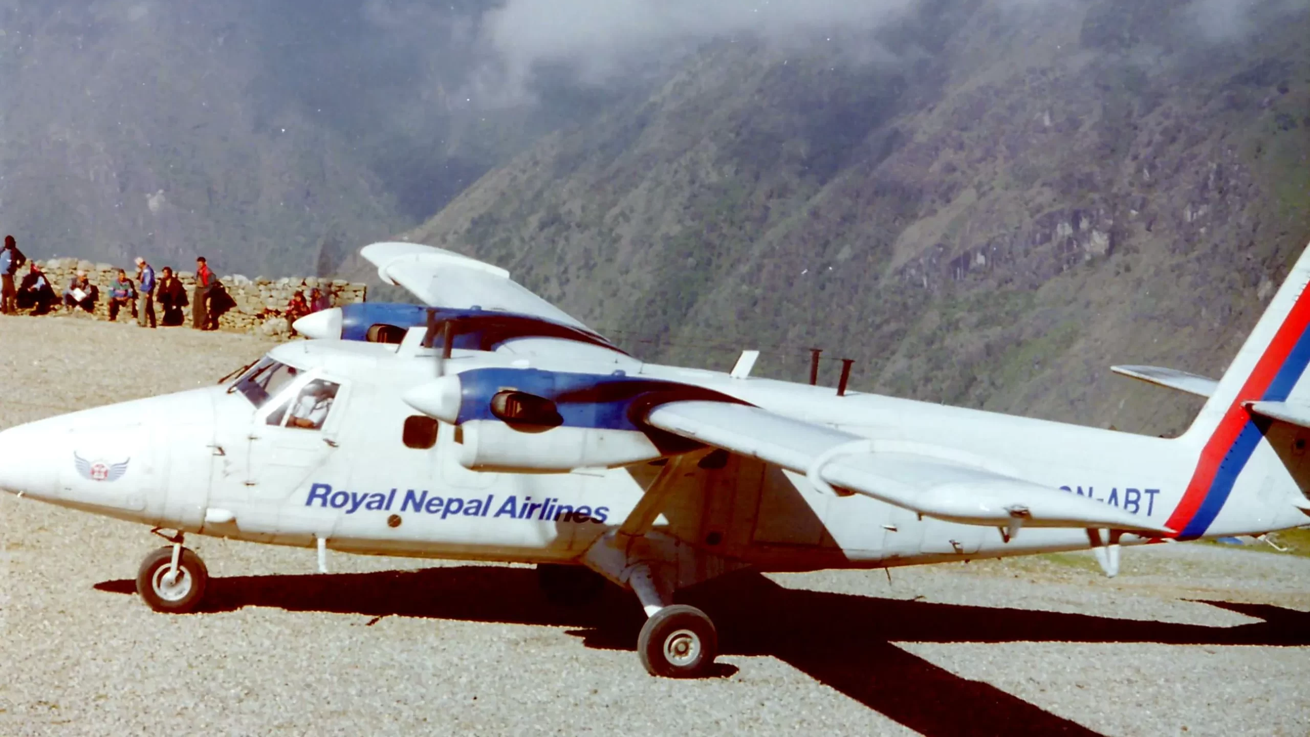
The aircraft in the picture is currently more than 40 years old, though the carrier has stopped its services in Lukla. According to Captain (and flight instructor) Rabindra Dangol, the Nepali flag carrier never had regular scheduled passenger service to/from Lukla Airport.
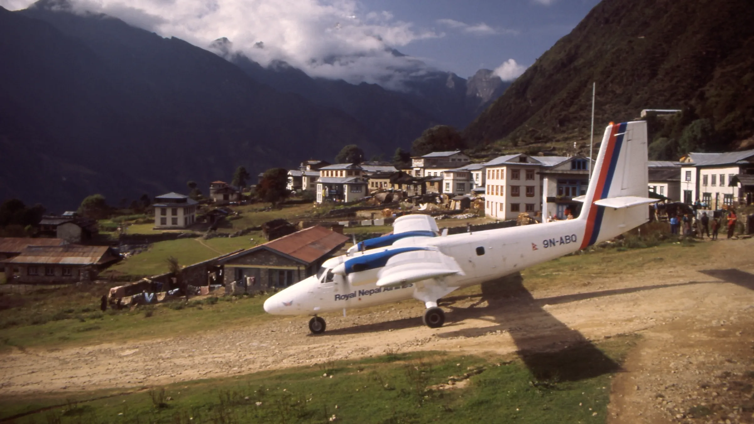
This is another DHC-6 Twin otter that Nepal Airlines used to operate to Lukla. According to data from planespotter.snet, this aircraft suffered damage to the nose landing gear when after a hard landing in Nepalgunj. After that it was stored at Kathmandu until 2012 and leased to Tara Airlines, and entered service with this carrier in May 2012.
Yeti Airlines
Yeti Airlines was the first airline in Nepal to be recognized as a Carbon neutral airline- though there has been a case in Europe where major carriers such as Lufthansa have been accused of greenwashing their customers. Yeti Airlines was the same carrier that was involved in the crash of Flight 691 (an ATR 72) that led to the loss of lives of all 72 people onboard.
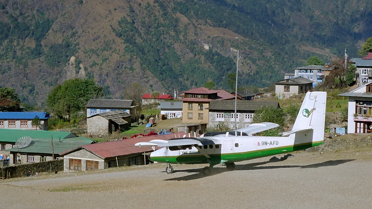
DHC-6 “Twin Otter” (9N-AFD) from Yeti Airlines taking off at Lukla Airport, Nepal in November 1999. Sadly after some years, this aircraft crashed in Lamjura hill while on approach to Lukla on 25 May 2004.
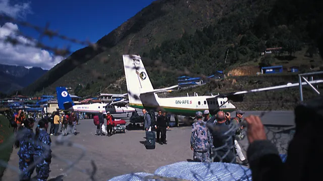
Lukla Airport isn’t as heavily guarded as it is shown in this picture (of Yeti Airlines’ Twin Otter registered 9N-AFE) taken in 2005 anymore. You can see a number of security personnel here because authorities fear the Maoists. In 2005 alone, Maoists were “responsible for the deaths of at least 263 civilians and 330 government security forces”, reported UNHCR. Lukla (and the Khumbu region in general) was one of the least affected places during the Maoist insurgency in Nepal. 9N-ANE later crashed while on its way to Lukla, and following plaque is a memorial dedicated to the accident.

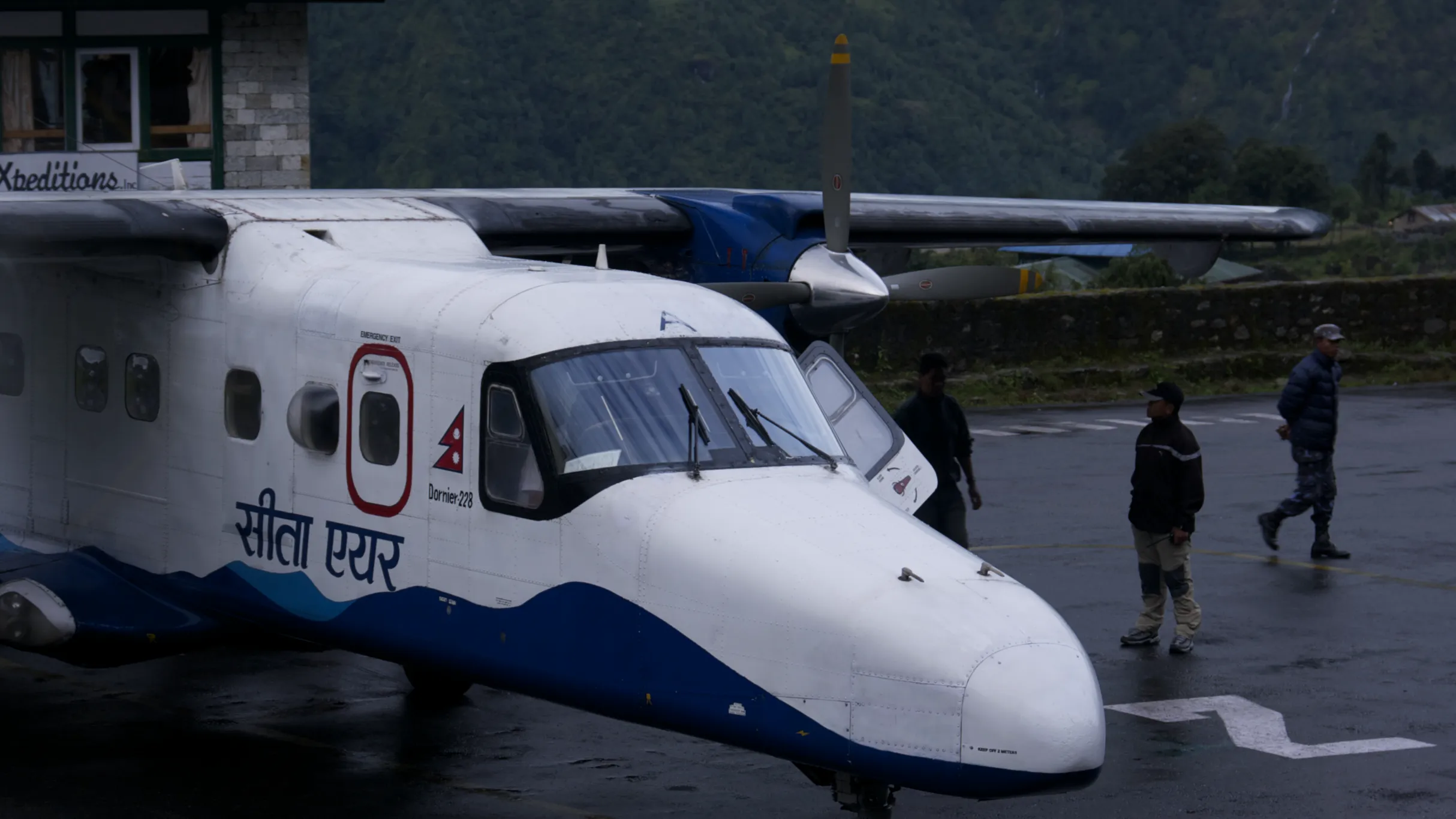
Agni Air
Agni Air was established in 1997 and began operations in 1998. The airline operated a fleet of small aircraft, including the Dornier 228 and the ATR 42, which are suitable for short-haul flights and can operate from shorter runways.
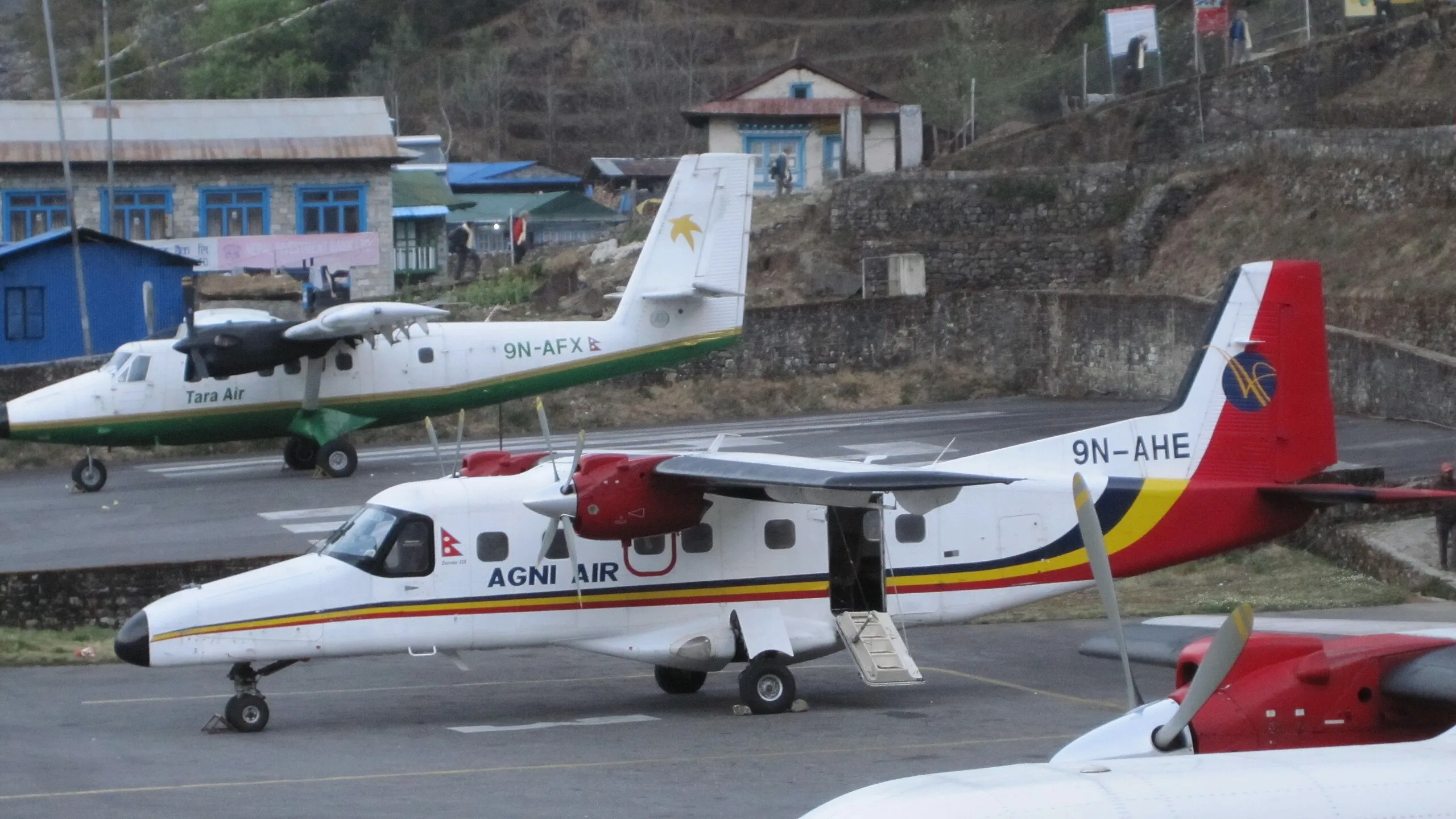
9N-AHE was involved in a tragic accident on August 24, 2010, during a flight from Kathmandu to Lukla. The flight crashed approximately 50 miles south of Kathmandu, resulting in the loss of all 14 people on board, including eight Nepalese and six foreign nationals.
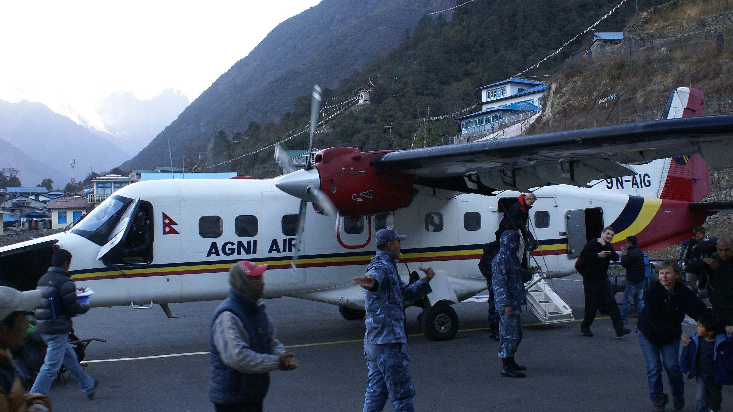
9N-AIG operated by Agni Air (shown in the photograph above) at Lukla Airport after the landing, a police officer showed the way to the passengers. A few months after this photograph was captured, the aircraft crashed in another STOL airport it was operating to – Jomsom Airport. The accident led to the loss of lives of 15 of the 21 people on board.
Simrik Air
The word Simrik in the Nepalese language refers to “Crimson” color, the national color of the nation. The airline was a partner of Simirik Air, a helicopter service provider in Nepal. The airline operated a Dornier Do-228 to Lukla.

This is one of the rare photographs of Simrik Airlines’ operations in Lukla. This aircraft registered 9N-AJH is currently in Sita Air’s fleet. In 2019, the Civil Aviation Authority of Nepal found that the airline was using sub-standard spare parts on the Beechcraft 1900 it was operating to other parts of the nation.
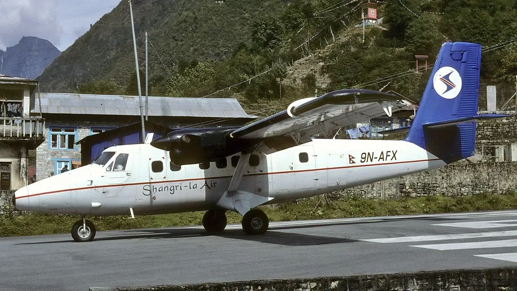
Shangri-La Airlines
Shangri-La Airlines was another airline that used to operate in Lukla, albeit very briefly. It used to operate Twin Otters in this region.
One of its planes of the same type registered 9N-AFR, “departed Jomsom at 09:41 for a 25-minute flight to Pokhara, carrying 15 tourists. The aircraft crashed against a hill which was under complete cloud cover following 3 days of continuous rains.“, reported Aviation Safety Network.
Skyline Airways
The following is a photograph of a DHC-6 registered 9N-AGF and operated by Skyline Airways at Lukla Airport and getting ready to take off. After a year of capturing this picture, this aircraft also crashed.
The aircraft got into an accident as it crashed against the Gargare Danda hill (in western Nepal) in bad weather. Two crew and two passengers on board were killed.
Goma Airlines
We can’t say whether Goma Air was a carrier of the past that used to operate in Lukla. This is because the airline is currently known as Summit Air and has regular passenger operations to Lukla. One reason I decided to include this carrier on this list is because of the fateful Goma Air flight 409, which crashed in Lukla.
Goma Air Flight 409 was headed to Lukla but eventually crashed. The accident report read that the aircraft:
” entered Lukla valley at 9,200 ft. which normally should be 10,500 ft. That counted as a violation of SOPs (both GOMA AIR as well as Lukla Airport SOP). The flight crew were not able to see the final glide path for landing to runway 06 and they were informed about the rapidly increasing thick fog towards the left as well as the right base of runway 06.”
Some of the causes of the crash included:
- Critical terrain and rapidly deteriorating weather condition.
- Pilot’s loss of situational awareness
- Voilation of SOP by the ATS and Pilot as well.
The investigation report found out that despite deteriorating weather, the ATS officer hadn’t closed the airport, as was required by the Standard Operating Procedures.
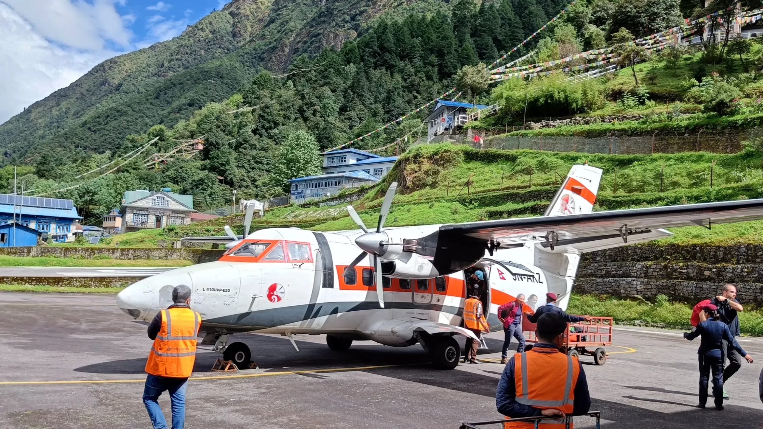
Summit Air has regular passenger operations to Lukla using Let L-410 Turbolet, the same aircraft type that was involved in the accident. The following photograph is of Summit Air’s Let L-410 in Lukla.
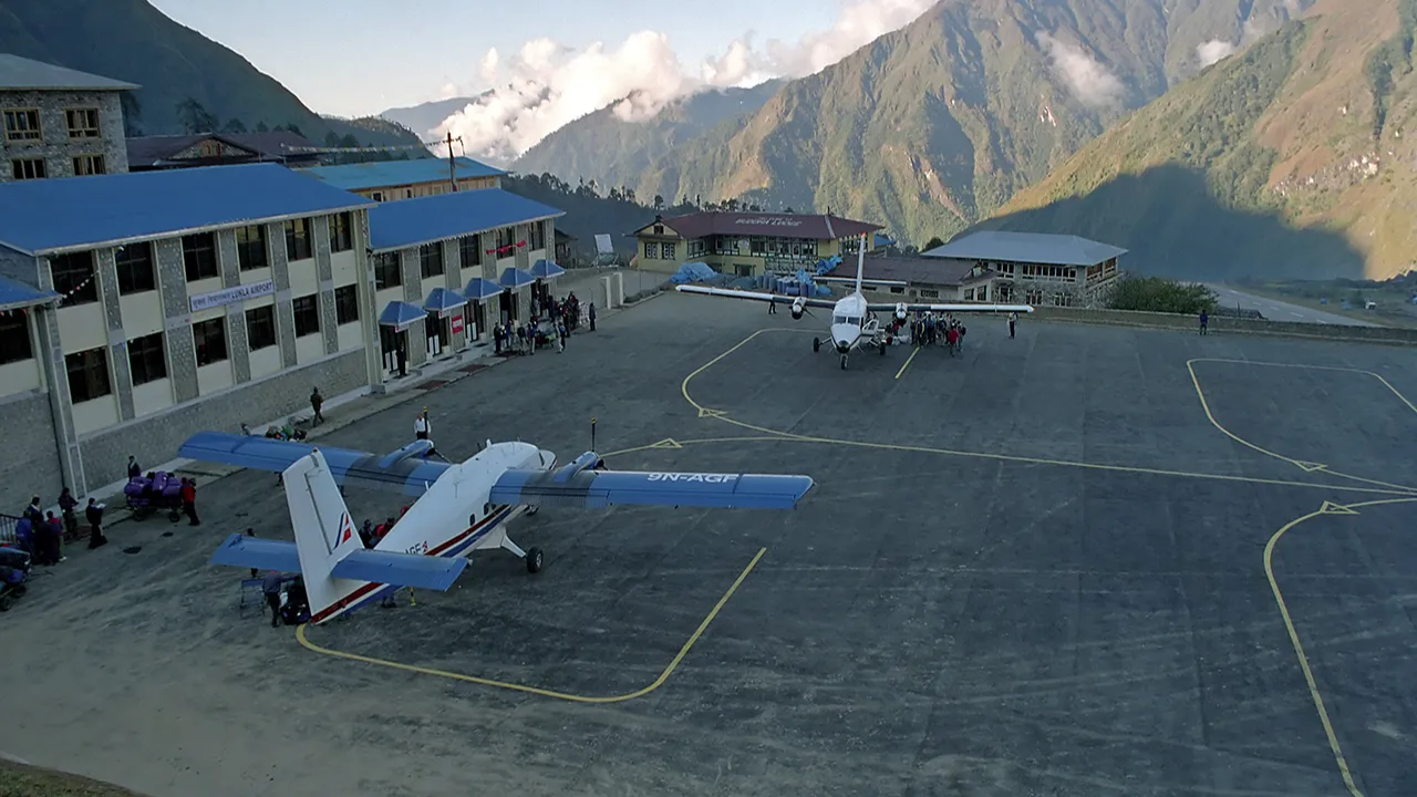
Airlines Currently Operating in Lukla
The following photograph is of a de Havilland Canada DHC-6 Twin Otter on Lukla Airport. Before the takeoff, we can see passengers waiting to get in the aircraft with the mesmerizing view of the mountain in the background of Lukla airport in 2006. The mountain that lies to the right of the empennage of the aircraft is Khumbuilaa – the protector god of the Khumbu region, which houses Lukla valley, the Everest, among others.
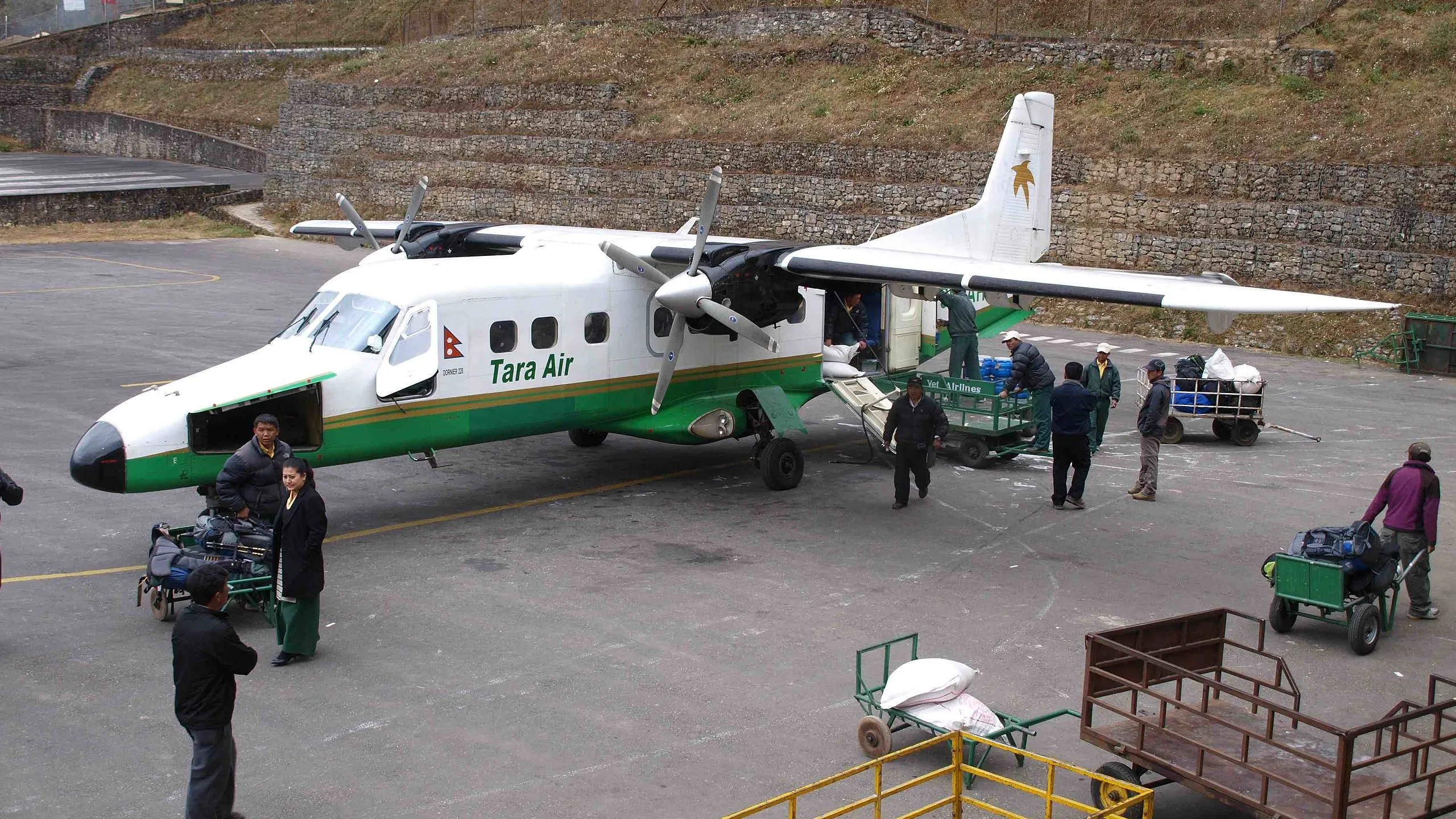
Tara Air
Tara Air is a subsidiary of Yeti Airlines, and used to operate Dornier Do 228s to Lukla. But this isn’t the case anymore as its fleet comprises of Twin Otters, as the following table suggests:
| Reg | Aircraft Type | Config | Delivered | Age |
|---|---|---|---|---|
| 9N-AEV | De Havilland Canada DHC-6 Twin Otter | Y19 | Nov 2009 | 45 Years |
| 9N-AKL | Viking DHC-6 Twin Otter | Y19 | Jul 2015 | 10.7 Years |
| 9N-ALO | Viking DHC-6 Twin Otter | Y19 | Jul 2018 | 14.9 Years |
Data: Planespotters.net
Before 2009, Yeti operated in STOL as well as non-STOL fields in Nepal. However, after 2009, the airline established Tara Air – its subsidiary which would operate in STOL fields such as Lukla, Simikot Airport, among others.
Sita Air
Sita Air, one of the three current operators to Lukla, operates a fleet of Dornier Do-228s. The following photograph is of its fixed-wing registered 9N-AHA at Lukla Airport getting ready to take off and waiting for passengers.
This aircraft was destroyed when it crashed shortly after takeoff from Kathmandu-Tribhuvan Airport (KTM), Nepal. All 19 on board were killed. The aircraft had also met a bird strike following take-off.
`Photo: Brendan Hickey | Wikimedia Commons
Snippets of the History of Crashes in Lukla- the most dangerous airport
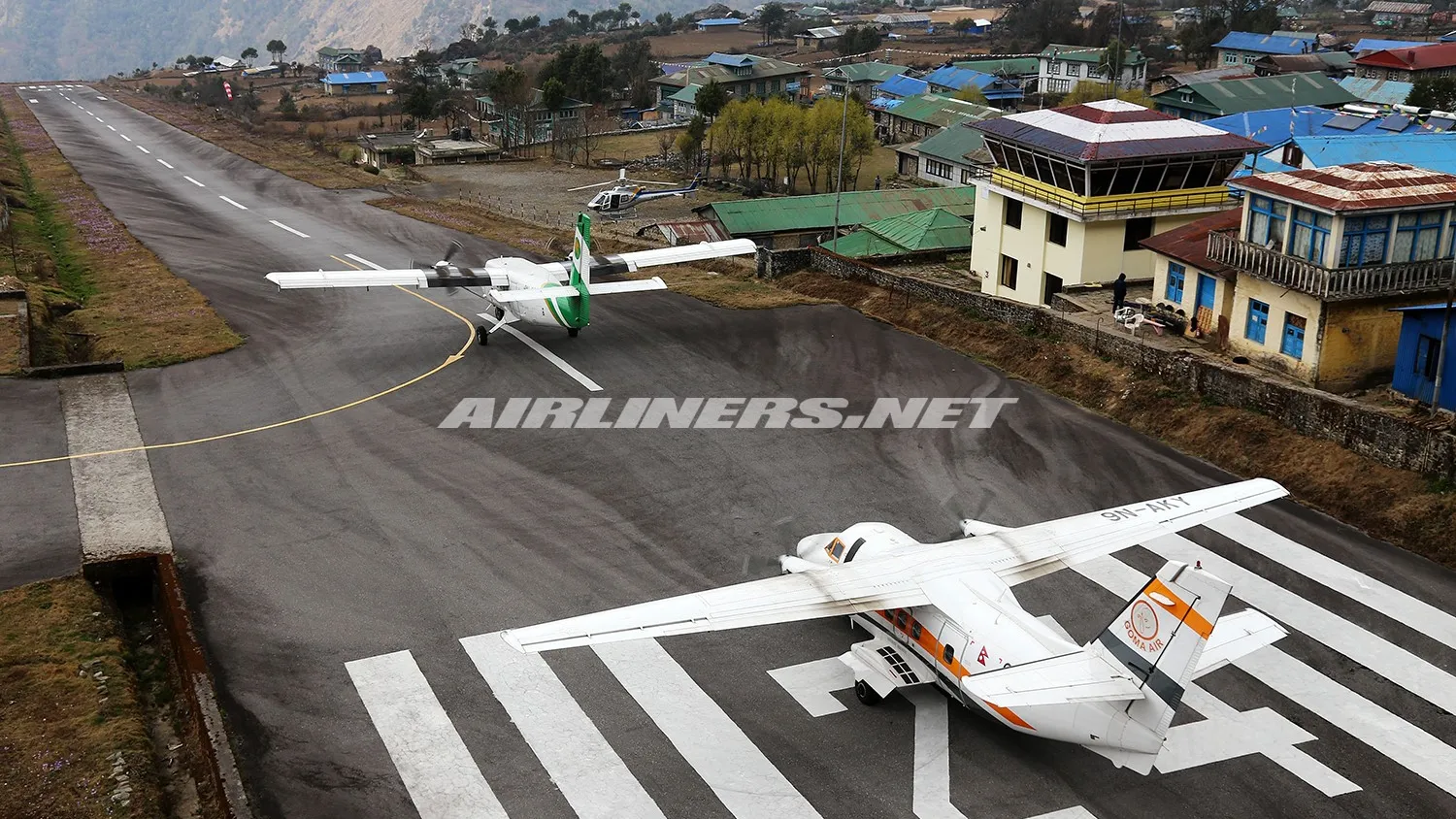
In 2019, a Summit Air Let L-410UVP-E20 (registered 9N-AMH) Turbolet collided with a Manang Air Eurocopter AS 350B3e helicopter (registered: 9N-ALC) [remember the AS350 B3 is the helicopter type that has landed at the top of Everest] during a takeoff attempt at Lukla Airport. Both aircraft involved in the collision were written off while one helicopter (Shree Airlines Eurocopter AS 350, 9N-ALK) sustained minor damage. The co-pilot of the Summit Airplane sustained fatal injuries.
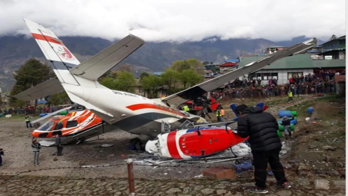
Two persons on the ground at the helipad also died in the accident. After the accident, the investigation committee recommended that a separate helipad be built. The helipad has now been constructed to the right of Runway 06. After this fatal crash, no fatalities have been recorded in accidents in the airport.
Lukla Airport Crashes & Incidents Overview
| Year | Airline / Operator | Aircraft Type | Registration | Phase of Flight | Fatalities |
|---|---|---|---|---|---|
| 2019 | Summit Air (formerly Goma Air) | Let L-410UVP-E20 | 9N-AMH | Takeoff roll | 3 (including 2 on ground) |
| 2017 | Goma Air (now Summit Air) | Let L-410 | 9N-AKY | Final approach | 2 (crew) |
| 2012 | Sita Air | Dornier Do-228 | 9N-AHA | Initial climb (departing TIA for Lukla) | 19 |
| 2010 | Agni Air | Dornier Do-228 | 9N-AHE | En-route (returning to Kathmandu) | 14 |
| 2008 | Yeti Airlines | DHC-6 Twin Otter | 9N-AFE | Landing | 18 |
| 1992 | Royal Nepal Airlines | Harbin Y-12-II | — | Takeoff | 0 |
| 1991 | Royal Nepal Airlines | DHC-6 Twin Otter | — | Landing | 0 |
To look at the detail of the history of aircraft in Lukla region, you can refer to our guide below:
Lukla Airport Crashes: An In-Depth Analysis of the World’s Most Dangerous Runway
Snippets of Other Historical Facets of Lukla
In the following picture, you can see a clothesline adjacent to Lukla airport where clothes are being hung to dry near the airport.
Despite having a paved runway, it is interesting to note that the airport had some vestiges of the years gone by – the daily activities of Lukla’s residents and the airport were almost intertwined – much like the kids of the yesteryears that would walk in the runway before a siren call asked them to step aside.
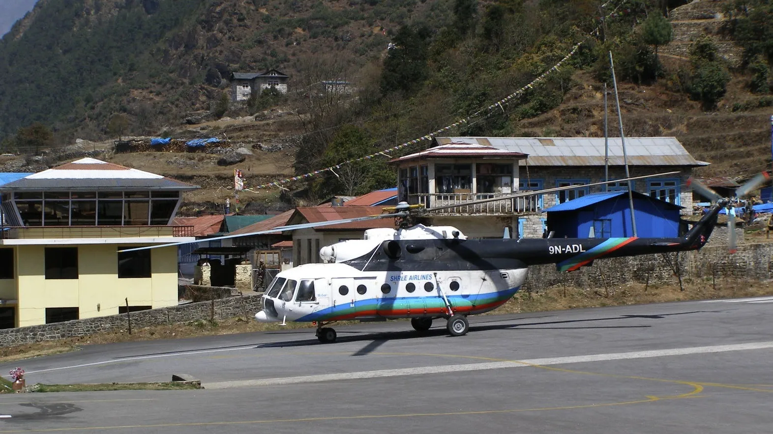
This is a picture from 2007 of an Mi-17 helicopter owned (and operated) by Shree Airlines. The Mi-17’s sight was a regular occurrence in Lukla. Its STOL capabilities coupled with a unique combination of high-altitude performance and power made it one of the very few helicopter types that have operated in Lukla. However, spotting one of these in Lukla would be difficult, as most helicopter operators have shifted to AS350B3Es. One could spot it in one of the alternatives to Lukla Airport – Phaplu Airport – though, as you can see in the picture below.
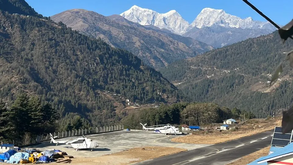
Photo: Chhutin Sherpa | aviospace.org
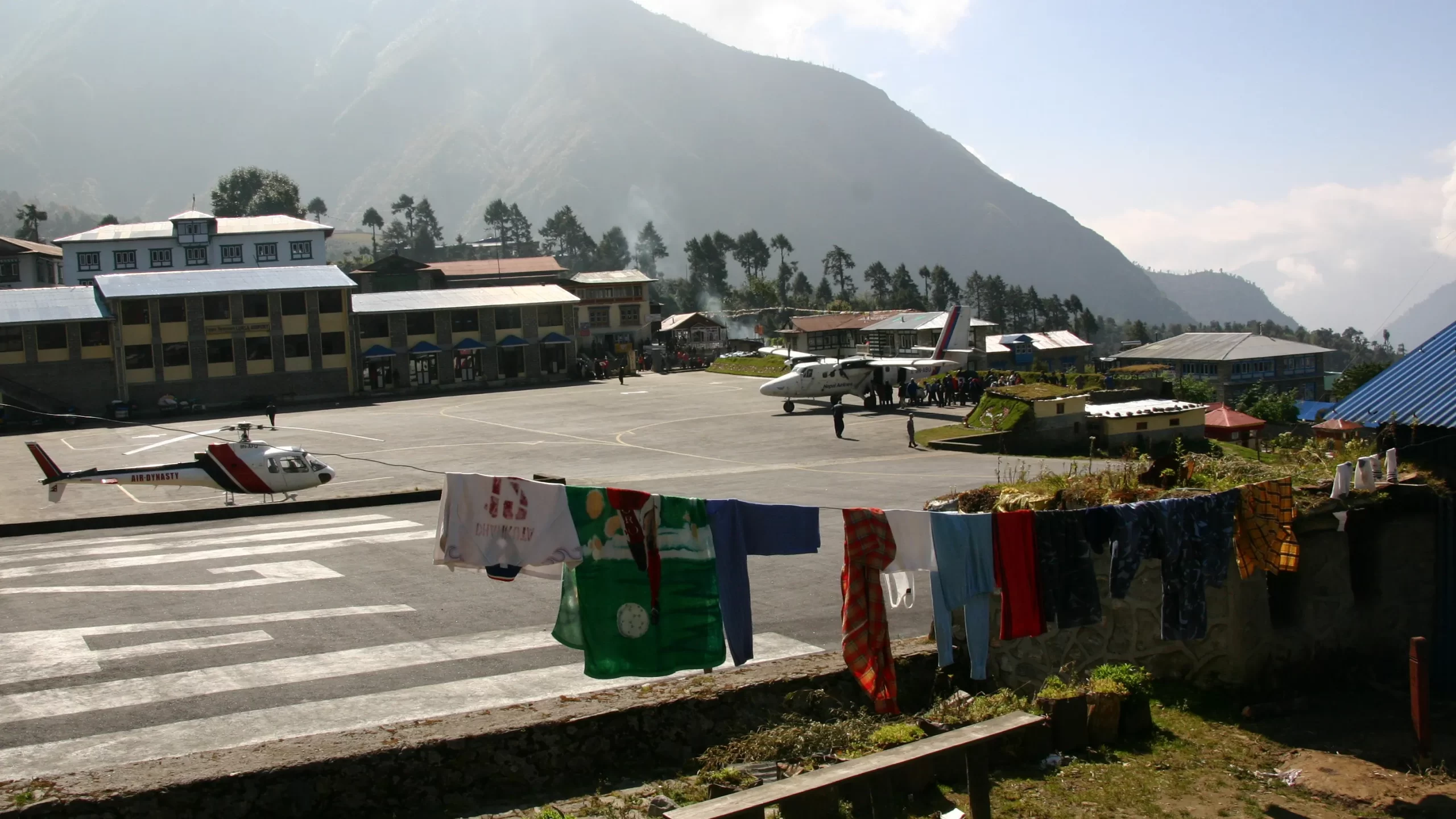
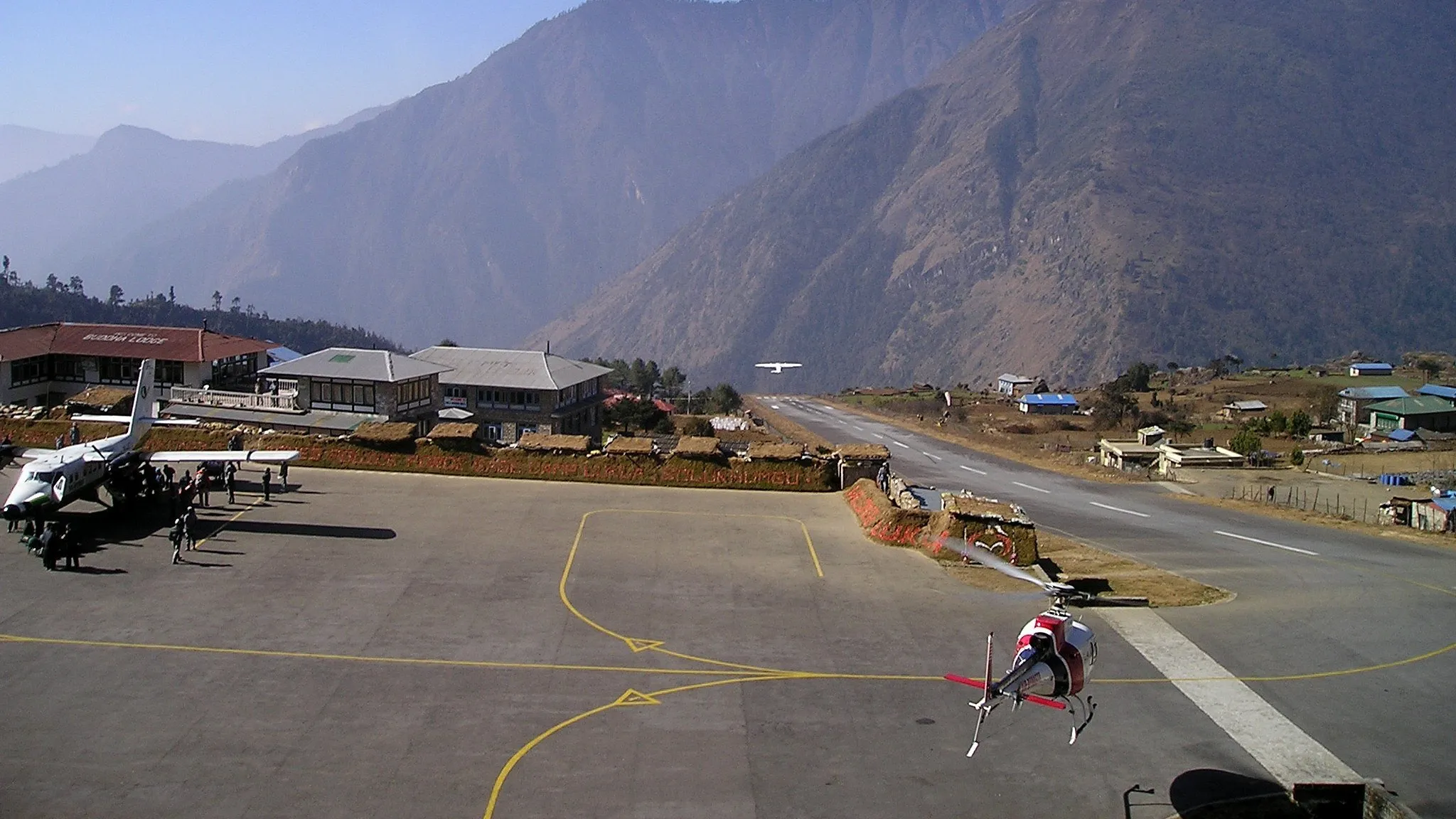
This following picture shows how fixed-wing aircraft as well as helicopters would operate in Lukla airport almost simultaneously. Currently, Lukla Airport sees up to 50 airplane operations daily during peak seasons. On top of that, chopper services for rescue and tourism, create a densely operated airfield.
It was this close proximity of operations of helicopter operations and fixed-wing operations that led to the collision of a fixed-wing with an AS350 that we touched upon previously.
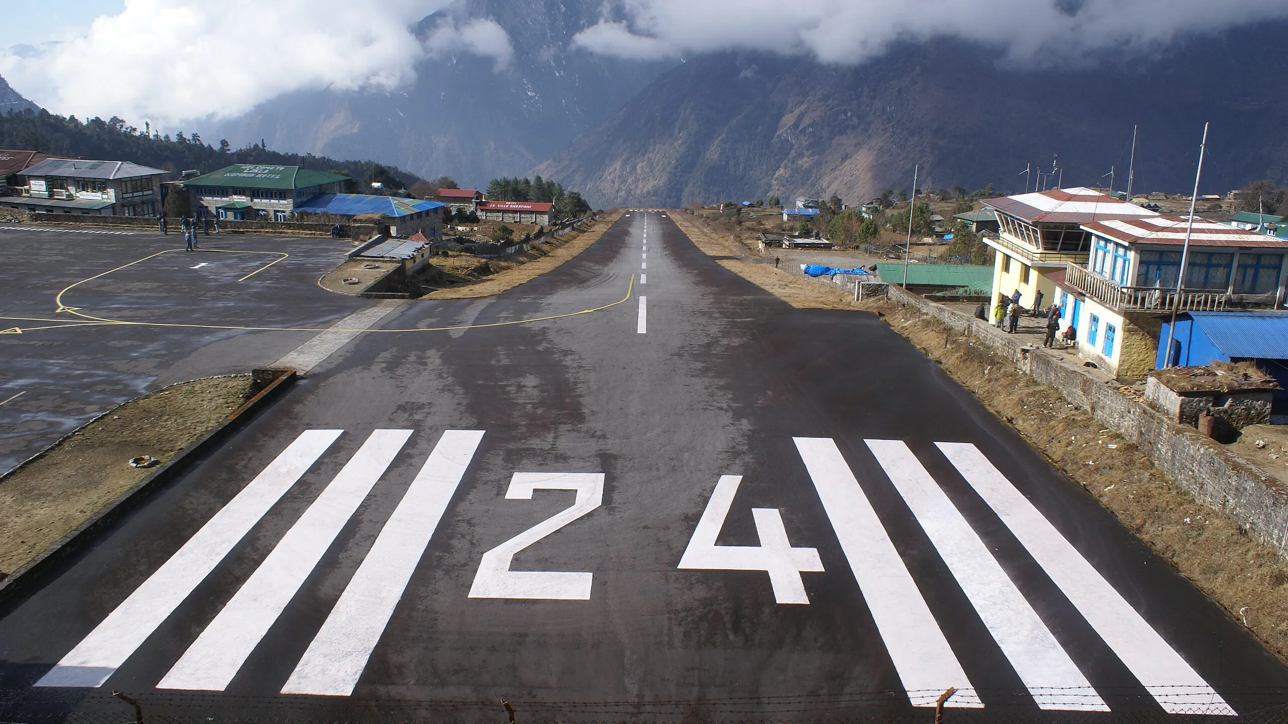
Lukla’s runway wasn’t even adequately graded until 2001, In 2001 the runway was paved and improved safety and efficiency. From runway 24, aircraft venture outwards of Lukla Airport. The runway from where aircraft land is known as Runway 06.
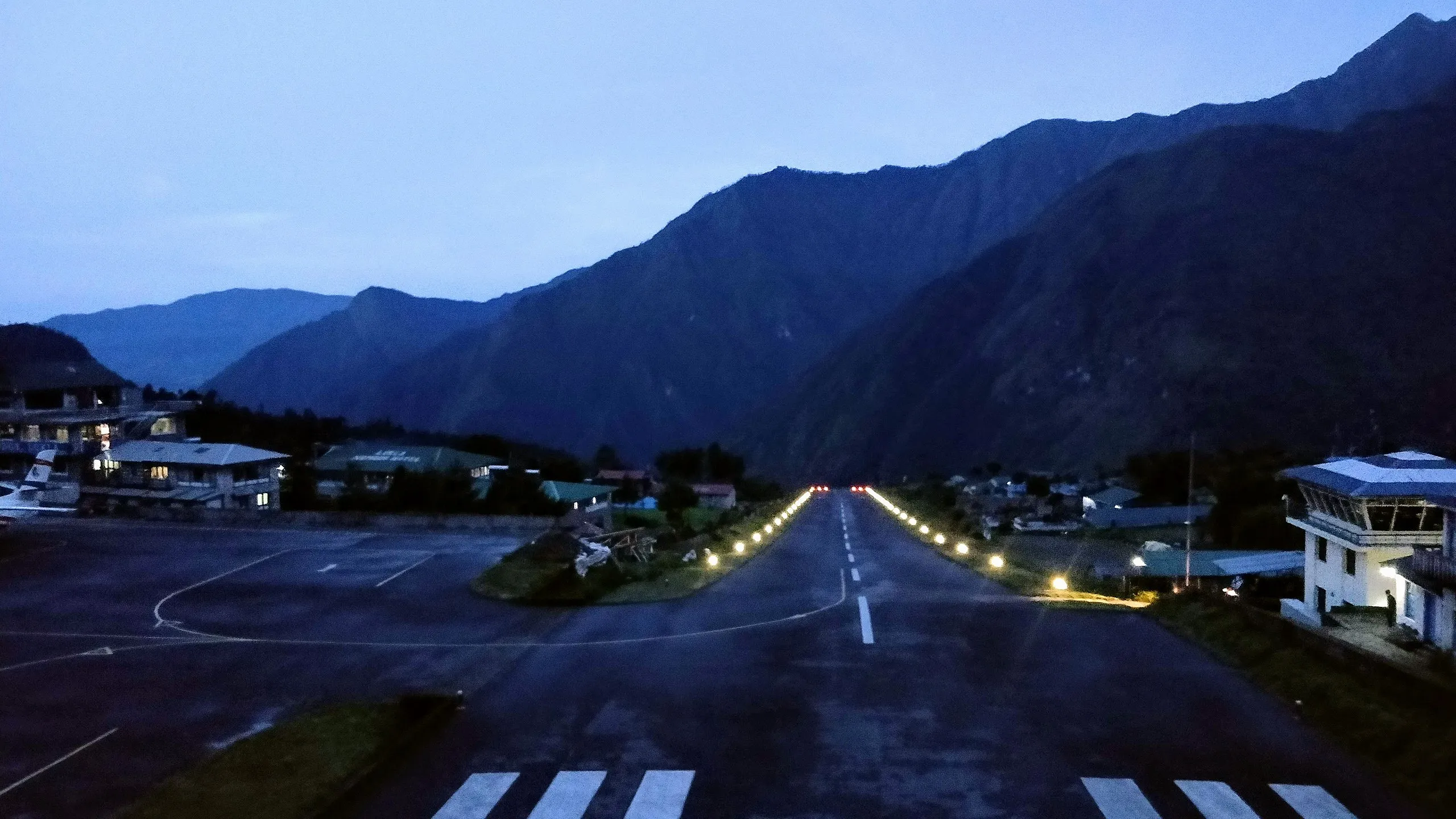
The evening view of the Lukla airport. There are no night flights in Lukla airport as the aircraft operations in this airport are all limited to Visual Flying Rule (VFR).