Indonesian search and rescue teams have located the wreckage of an ATR 42-500 turboprop aircraft with 11 people on board that disappeared on 17 January 2026 while approaching Sultan Hasanuddin International Airport (UPG), Makassar, Aljazeera reported. The flight, chartered for a maritime surveillance mission, was en route from Adisutjipto Airport (JOG), Yogyakarta when it lost radar and radio contact, and led to emergency operations.
.jpg)
The discovery on a steep slope of Mount Bulusaraung in South Sulawesi province has yielded fuselage sections, engine components and at least one recovered body amid ongoing search efforts, despite the fact that adverse terrain and weather continue to hamper operations.
Indonesia Air Transport (I8): Airline Profile
This table outlines Indonesia Air Transport, the operator of the ATR 42-500 (an ATR 72 was involved the fatal crash in Pokhara Nepal a few years ago) involved in the crash, summarizing key corporate and operational attributes.
| Attribute | Details |
|---|---|
| Airline name | Indonesia Air Transport |
| IATA / ICAO / Callsign | I8 / IDA / INTRA |
| Founded | 1968 |
| Headquarters | Jakarta, Indonesia |
| Main hub | Halim Perdanakusuma International Airport (HLP), Jakarta |
| Fleet size | 2 (multiple aircraft types historically) |
| Operations | Charter, passenger, cargo, industry services |
| Safety category | Category 1 (Indonesian Civil Aviation Authority) |
Indonesia Air Transport: Flight & Crash timeline
The ATR 42-500, chartered for the Indonesian Marine Affairs and Fisheries Ministry, departed Adisutjipto Airport (JOG) destined for Sultan Hasanuddin International Airport (UPG), Makassar. On board were eight crew members and three ministry officials engaged in fisheries surveillance tasks.
The last radar and communication contact occurred shortly after 13:15–13:30 local time near the Maros region of South Sulawesi. Air traffic control had issued a course correction as the aircraft approached Makassar’s approach path; soon after, the aircraft vanished from radar.
According to a report published in Reuters:
“According to unconfirmed Flightradar24 data, an aircraft matching the description was flying eastward over the Java Sea at about 11,000 feet before rapidly losing altitude and dropping off tracking systems. In France, Franco-Italian planemaker ATR, said it had been informed of an accident in Indonesia and that its specialists were supporting local authorities as they began their investigation.”

But the wreckage was found later
On 18 January, joint rescue teams located significant debris — fuselage segments, seats and what is believed to be the engine — on a rugged slope of Mount Bulusaraung. At least one body has been recovered within a ravine, additional remains have been visually identified but remain inaccessible due to steep terrain and heavy fog.
Muhammad Arif Anwar, who heads Makassar’s search and rescue office, was quoted in Aljazeera to have said:
“The discovery of the aircraft’s main sections significantly narrows the search zone and offers a crucial clue for tightening the search area…..Our joint search and rescue teams are now focusing on searching for the victims, especially those who might still be alive.”
It has been reported that “rescuers on the ground then retrieved larger debris consistent with the main fuselage and tail scattered on a steep northern slope“.
However, search and rescue efforts have been slowed by poor visibility, strong winds and mountainous terrain, forcing intermittent pauses at nightfall.
Here’s a timeline of the event:
| Time (Local) | Event |
|---|---|
| ~13:17, 17 Jan 2026 | Last radar and radio contact with the ATR 42-500 near Maros District, South Sulawesi |
| 17:33, 17 Jan 2026 | Indonesian authorities formally launch search and rescue operations |
| ~04:00, 18 Jan 2026 | Joint SAR teams resume operations before dawn with expanded personnel and assets |
| 07:17, 18 Jan 2026 | Aerial patrols report first visual indications of aircraft debris |
| 07:46, 18 Jan 2026 | SAR units locate initial fragments of wreckage on a mountain slope |
| 07:49, 18 Jan 2026 | A large section of the aircraft fuselage is identified |
| 08:02, 18 Jan 2026 | Additional debris spotted by helicopter, confirming a wide debris field |
| ~14:20, 18 Jan 2026 | The body of one victim is found approximately 200 metres down a ravine |
Source: Antara News
.jpg)
Details of the (Possible) Victims
The aircraft impacted the slopes of Mount Bulusaraung within Bantimurung–Bulusaraung National Park, an area adjacent to the city of Makassar. On board the aircraft were three officials from the Ministry of Marine Affairs and Fisheries, along with seven crew members.
Arif was quoted in NBCRightNow:
“One male victim was found… at a depth of roughly 200 meters (656 feet) in the ravine and near aircraft debris,”
according to Basarnas (SAR), Indonesia’s national search-and-rescue agency’s Instagram Post, the victim “was found on the slope of the top of Bulusaraung mountain, the joint SAR is still evacuating,”, with the victim not yet been publicly identified.
The same source reported that Andi Sultan, another local search official, separately confirmed the recovery, adding that adverse weather conditions would delay the evacuation of the remains until Monday.
Sultan also told the Australian Broadcasting Corporation (ABC):
“Our helicopter crews have seen the debris of the plane’s window at 7:46 a.m….And around 7:49 a.m., we discovered large parts of the aircraft, suspected to be the fuselage of the plane.”
Arif also stated that aerial search units had been deployed to assist ground teams in locating the remaining occupants. Search operations, involving more than 1,000 personnel from the military, police and volunteer groups, have been ongoing on land and by air:
Minister Sakti Wahyu Trenggono said the employees were on a mission to conduct aerial monitoring of resources in the area….Local military chief Bangun Nawoko told reporters that the search was hindered by harsh terrain and fog.
Gen. Bangun Nawoko, was quoted in AP as having said that “visibility at the summit was about 5 meters (16 miles)“. The same source also said that the nation where the accident took place “relies heavily on air transport and ferries to connect its more than 17,000 islands”, and that the nation has been “plagued by transportation accidents in recent years, from plane and bus crashes to ferry sinkings.”

Evolution of the Aircraft — Age, History and Ownership
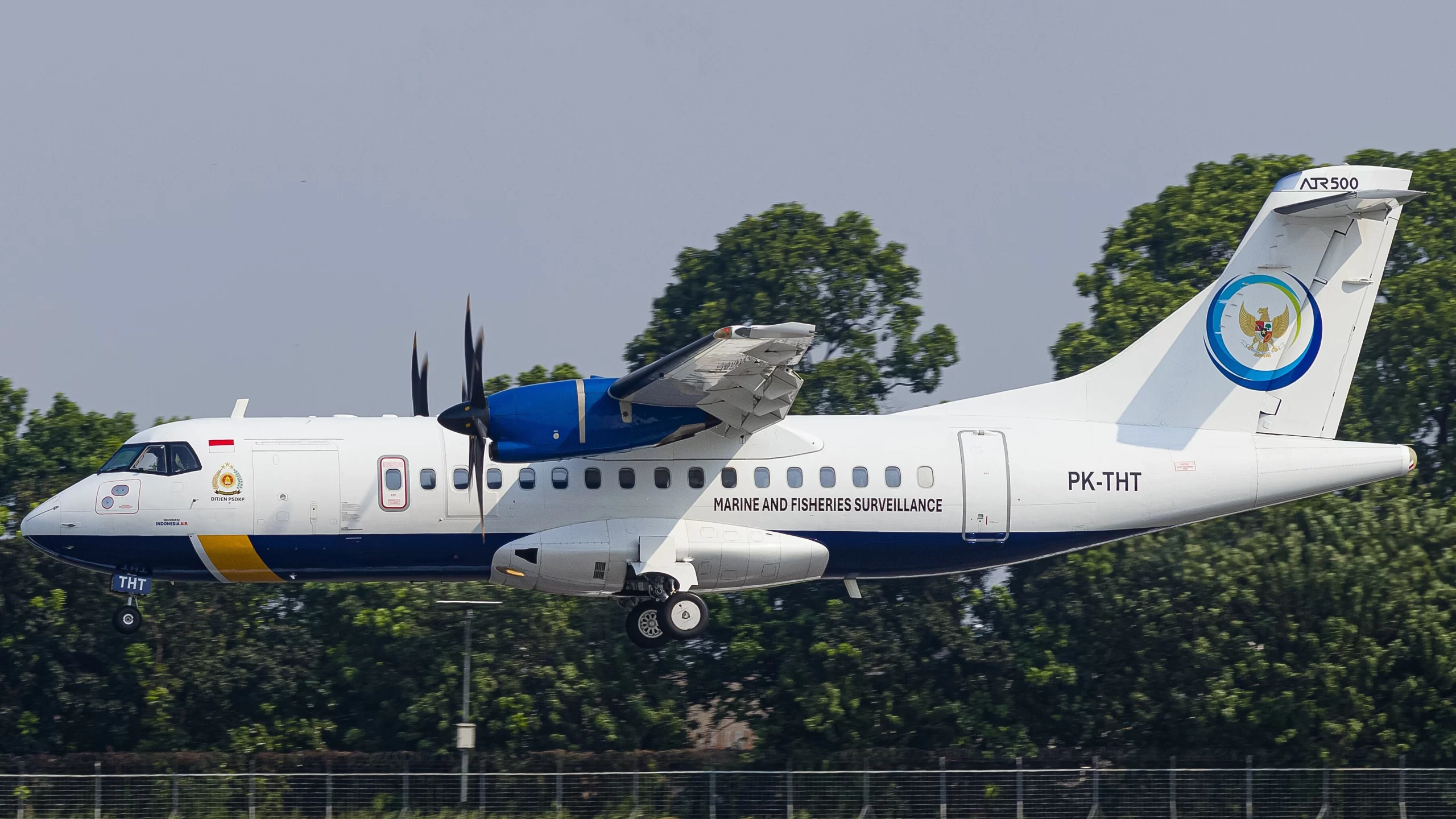
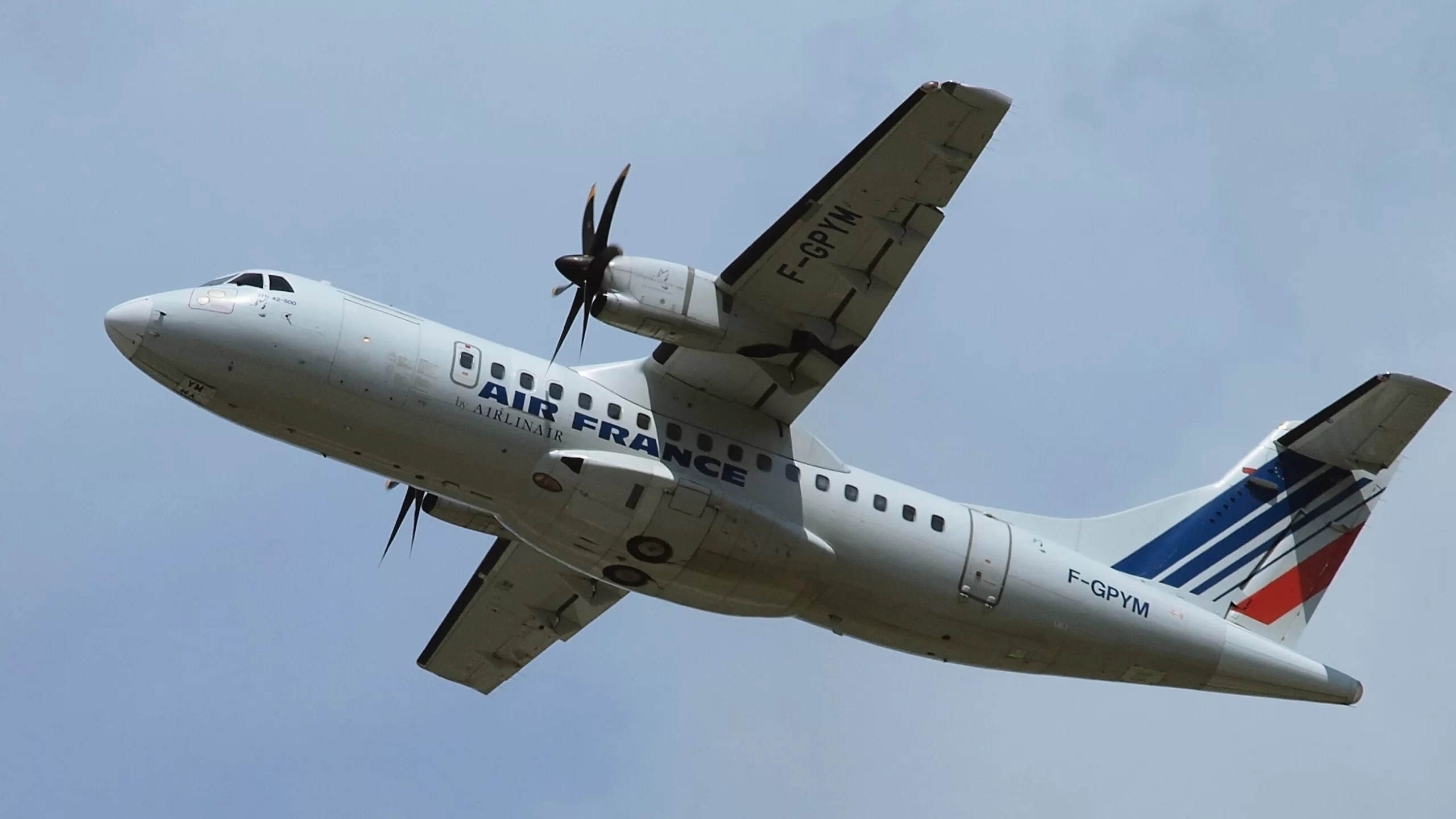
The aircraft involved in the accident was an ATR 42-512, a variant of the ATR 42-500 series, bearing the registration PK-THT and manufacturer serial number 611. It was originally delivered in 2000 to Air Dolomiti, before later changing ownership and entering service with Indonesia Air Transport. At the time of the accident, the turboprop was 25 years old, reflecting a long operational history across multiple operators prior to its final assignment.
| Registration | Airline / operator | Delivery date | Configuration | Hex code |
|---|---|---|---|---|
| I-ADLZ | Air Dolomiti | 23 Mar 2001 | Y46 | 300140 |
| PK-THT | Indonesia Air Transport | 12 Jul 2010 | Y46 (until Apr 2025) | 8A0239 |
| PK-THT | Marine and Fisheries Resources Surveillance (PSDKP), operated by Indonesia Air Transport | Mar 2025 | Airborne Surveillance | 8A0239 |
Data: planespotters.net
Other Details of the Crash
The discovery of a crashed ATR 42-500 wreckage near Mount Bulusaraung marks a somber development in an ongoing search for 11 aboard a flight chartered by Indonesia’s Marine Affairs and Fisheries Ministry, and according to Indonesia’s National Transportation Safety Committee head Soerjanto Tjahjono, the case might have been a “controlled flight into terrain (CFIT)…. The pilot was able to control the plane and the crash was not intentional..“
CFIT happens when a fully functioning aircraft, under pilot control, unintentionally collides with terrain, water, or obstacles. In such cases, pilots are often unaware of the imminent danger until it is too late.
CFIT incidents most frequently occur during the approach and landing phases, especially on non-precision approaches.
Common causes of CFIT include:
-
Loss of situational awareness, particularly in the vertical plane
-
Crash sites located on the centreline of an approach to an airfield
-
Lack of familiarity with the approach procedure
-
Misinterpretation of approach charts, especially where the approach requires step-downs in altitude from the initial approach fix to the final approach fix
According to Skybrary, a CFIT could be of two types:
| Scenario type | Description | Contributing factors |
|---|---|---|
| Pilot-induced situation | The pilot encounters worse-than-forecast weather and, attempting to maintain or regain visual contact with the ground in very low cloud, descends below Minimum Safe Altitude (MSA), causing the aircraft to strike terrain. | – Over-reliance on GPS while attempting to maintain Visual Meteorological Conditions (VMC) – Lack of adequate situational awareness of terrain |
| ATCO-induced situation | An air traffic controller vectors an aircraft at 210 KIAS toward the ILS centreline during an initial approach but becomes distracted and fails to issue the intercept heading for the ILS localizer (LLZ). The unfamiliar flight crew do not notice the problem in time, and the aircraft flies beyond the centreline into high terrain. | – Controller distraction – Flight crew unfamiliarity with the approach – Failure to detect and correct the deviation in time |